
Ganghwa County Visit – 2023 January
I just visited Seoul together with my wife for a short holiday as the air ticket prices for Asiana Airlines were good in January. We had a great time shopping and trying all the local Korean dishes, but the most exciting part of this holiday was my visit to Ganghwa Country, consisting of several islands close to the border of the DPRK.
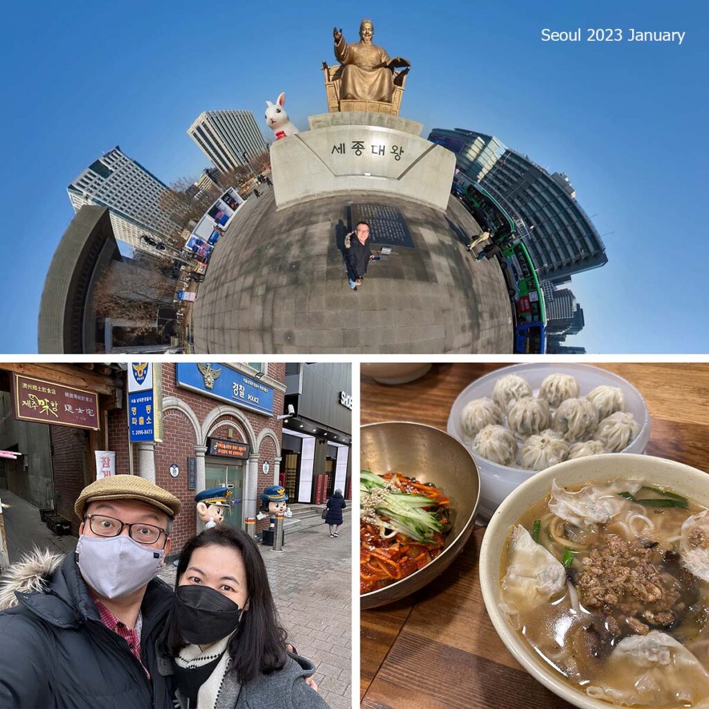
Check out my 360° photo of the Statue of Admiral Yi Sun Shin photographed while I was touring Gwanghwamun Square. In 2016, at this very spot I where I was standing, it was reported that over 200,000 protesters gathered to call for then President Park Geun-hye to resign.
My wife wasn’t keen to brave the sub zero temperatures out in the rural areas so I went alone with a local guide to explore the border of South Korea and the DPRK the very next day.
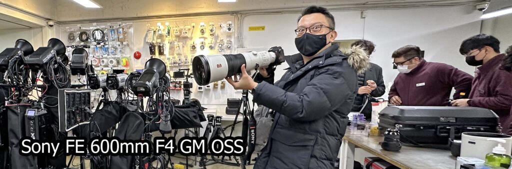
I set off early in the morning and arrived 7:30am at SLR Rent. They are open for business early so photographers can get a good head start.
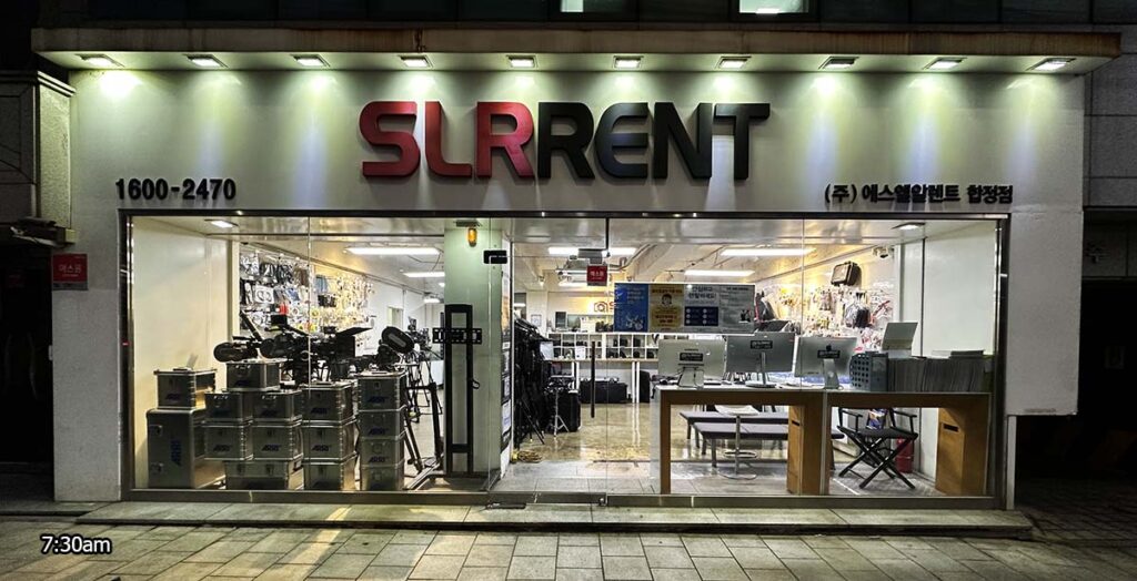
I rented the Sony FE 600mm F4 GM OSS to go with my Sony Alpha 7R IV 61 megapixel camera. I hoped to squeeze out the maximum detail out my photos today. It’s a wonderful lens but impractical for me to own one as it is over $12,000 and I’ll hardly use it. You have to put down a $2000 deposit and leave your passport with them before they let you walk out the store with it. The rental is only about $100 for 12 hours.
The journey to Gyodong Island was relatively smooth in the morning with moderate to light traffic. I left the radio on at 92.50MHz because there are pockets where South Korea’s radio jamming couldn’t cover and you can hear DPRK state radio broadcasts. It gets really clear once you’re right next to the border.
My first stop is the Gyodongdo Observation Park (교동도 망향대). You can check out the 360° view I uploaded to google maps here:
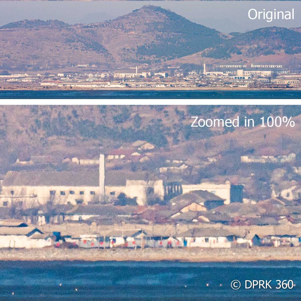
The view here is nice but my camera couldn’t resolve the details of the tiny movements I could see far away. It’s more than 6 kilometers away and I can barely make out the human figures moving about.
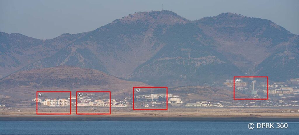
This first photo above shows the maximum reach of the 600mm lens I rented. The photos that follow are digitally zoomed in and cropped images from the 61 megapixel photo. You’ll notice these photos have wavy lines. This is because even at freezing temperatures, heat waves and different air densities still cause refraction over such long distances that distort the image being captured. There is currently no workaround and the effect will more pronounced in the summer.
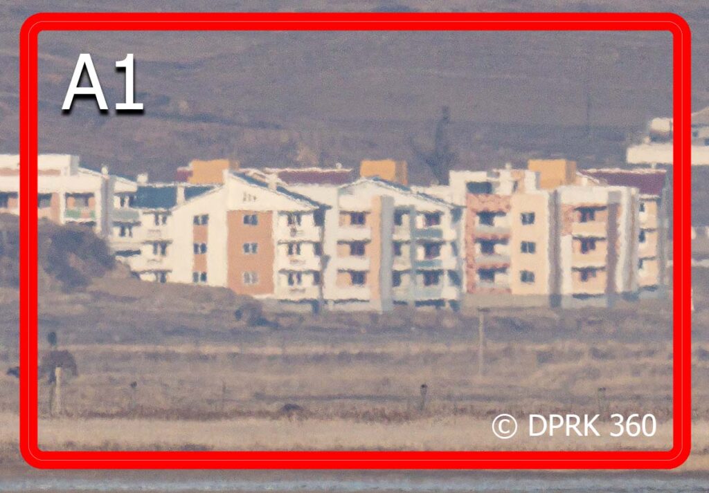
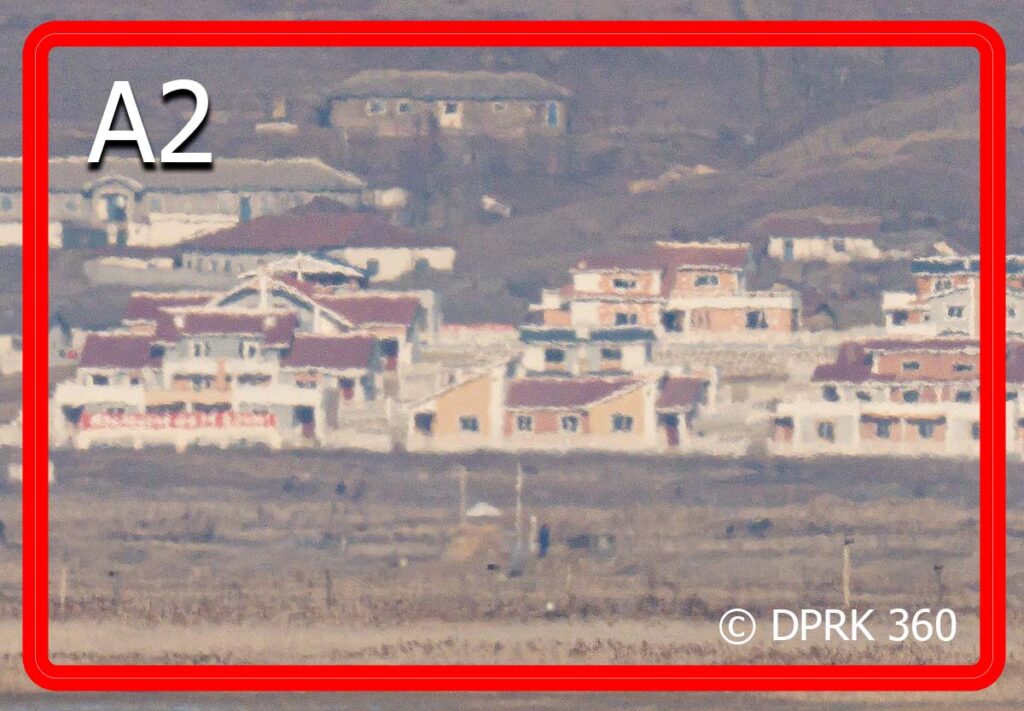
Panning across the horizon, I captured another view seen from Gyodongdo Observation Park. The red boxed images are zoomed crops of the photo below.
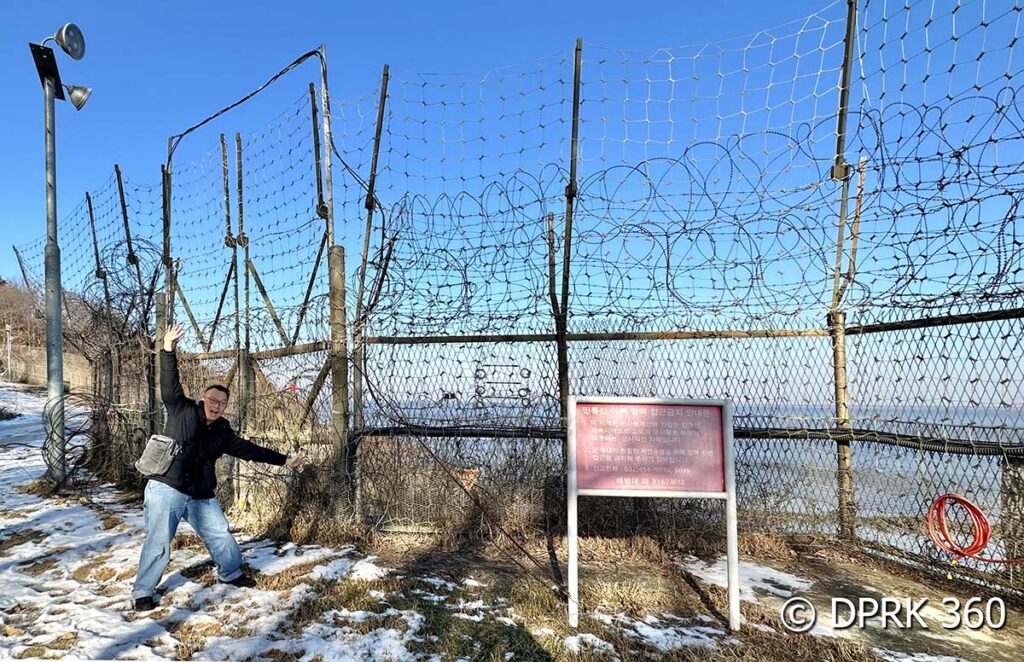
On the way to the next stop, I stopped by the South Korean border fence for a selfie photo. If you visit the fences, I don’t recommend you do anything stupid here to trigger the border alerts. Don’t touch or climb anything. If in doubt, apply a large dose of common sense.
The second stop is Nanjeongli Observatory (난정리전망대) situated next to a reservoir. The entire reservoir was frozen and the locals were fishing through holes they drilled in the ice,
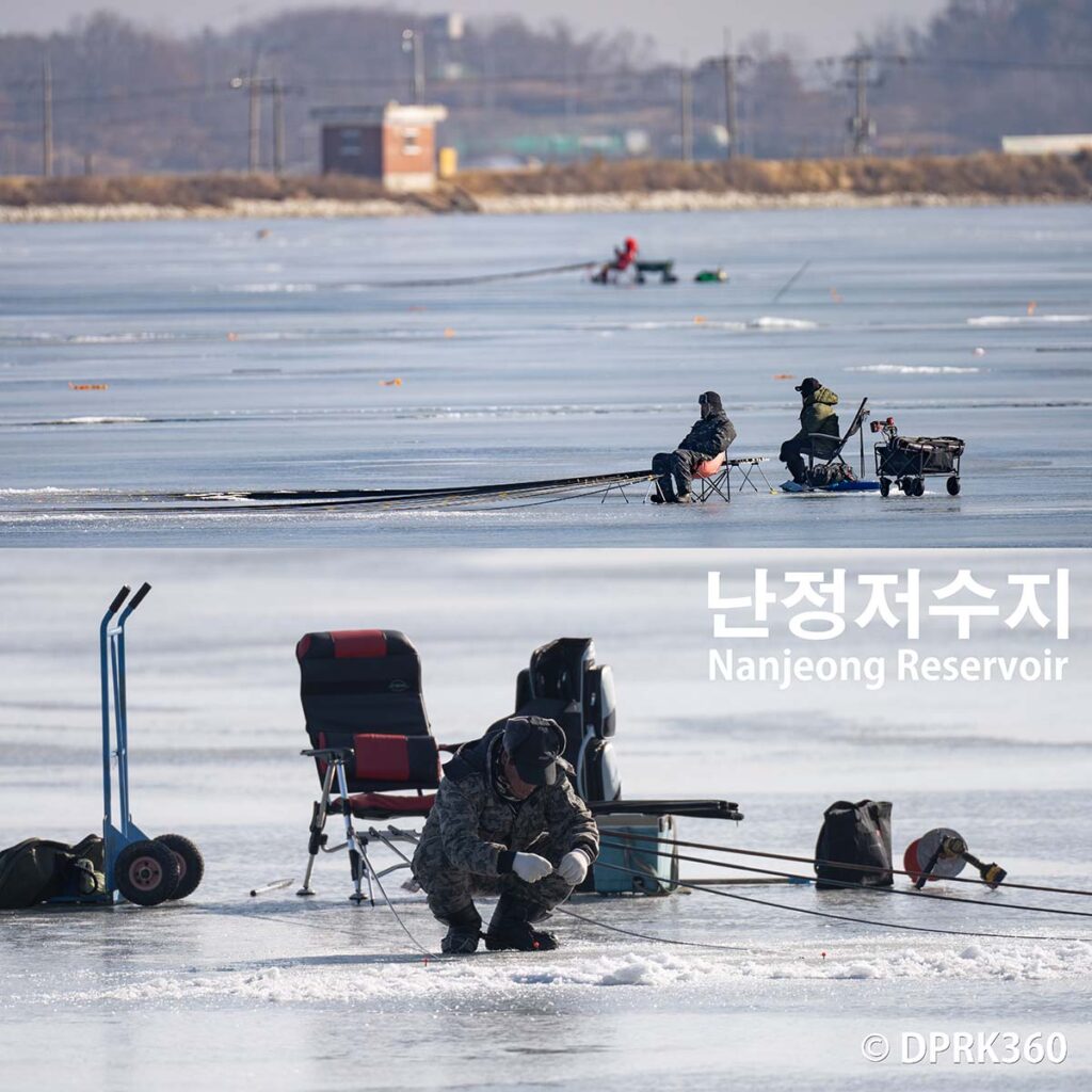
There’s an observation platform here that has a perfect view of the DPRK border.
Unfortunately it’s seems further away from here and I’m not getting much details in the photos. I decided to quickly move on to the next location.
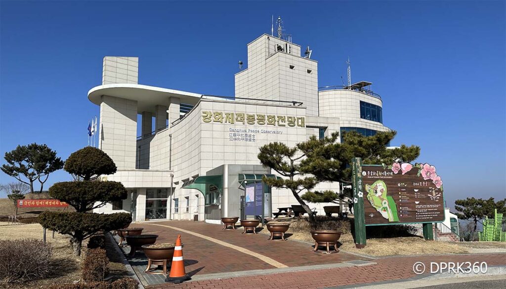
My third stop is the Ganghwa Peace Observatory (강화 평화전망대) on Ganghwa Island. It’s a military facility that was opened to the public in 2008. It’s around 4 kilometers away from the nearest points of interest in the DPRK.
Check out the 360° image of the observatory I uploaded to Google maps
I’m definitely getting clearer photos here because it’s closer to the north. It’s easier to see movement and people.
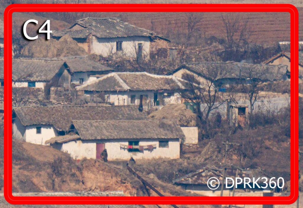
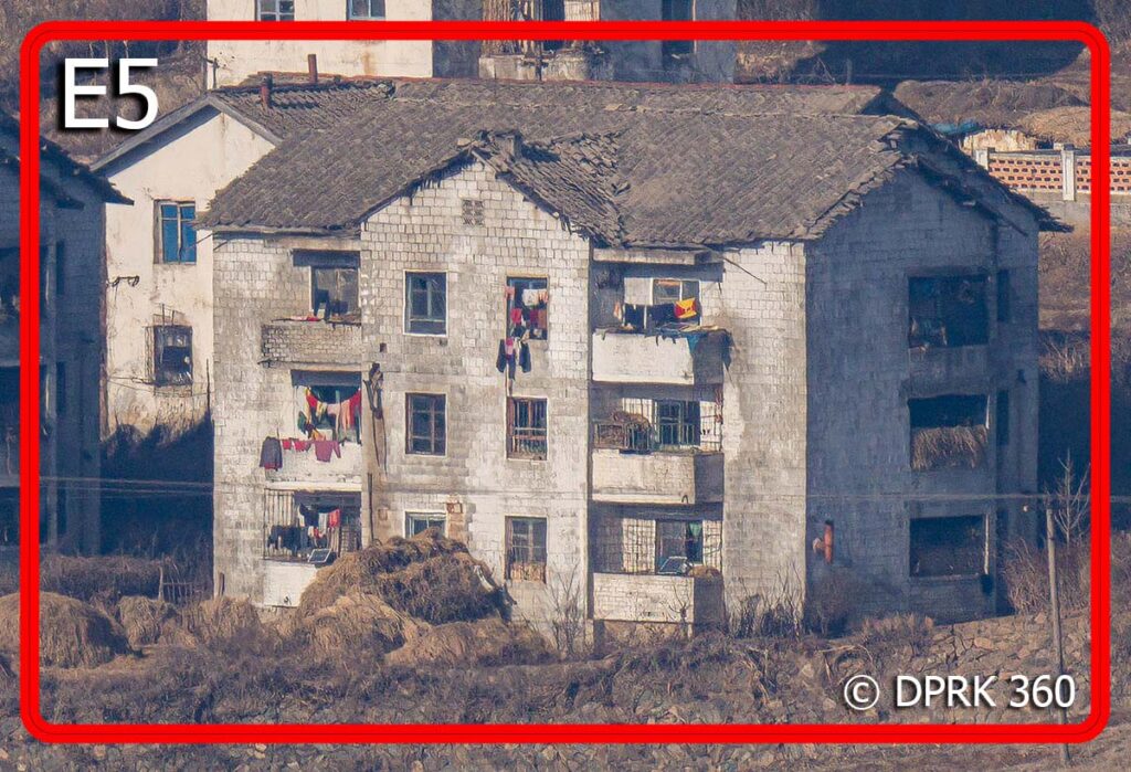
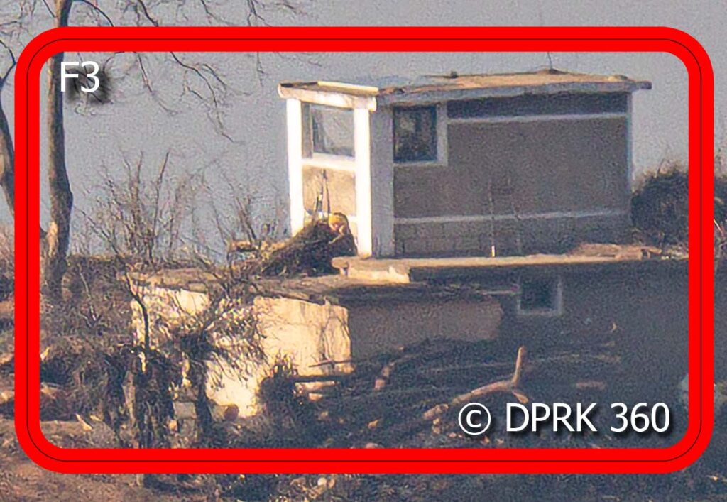
Here’s another photo of an area nearby. I finally get to see burial grounds for common people and not the elaborately constructed ones for decorated war heroes in Pyongyang.
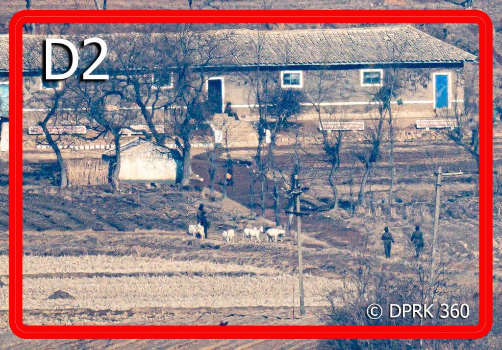
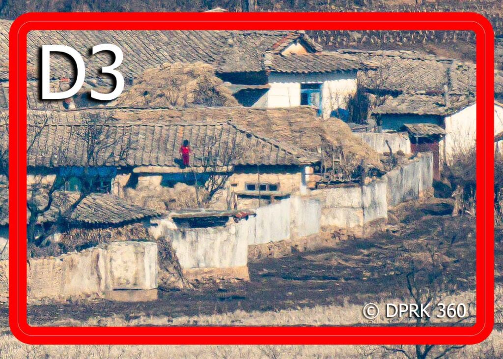
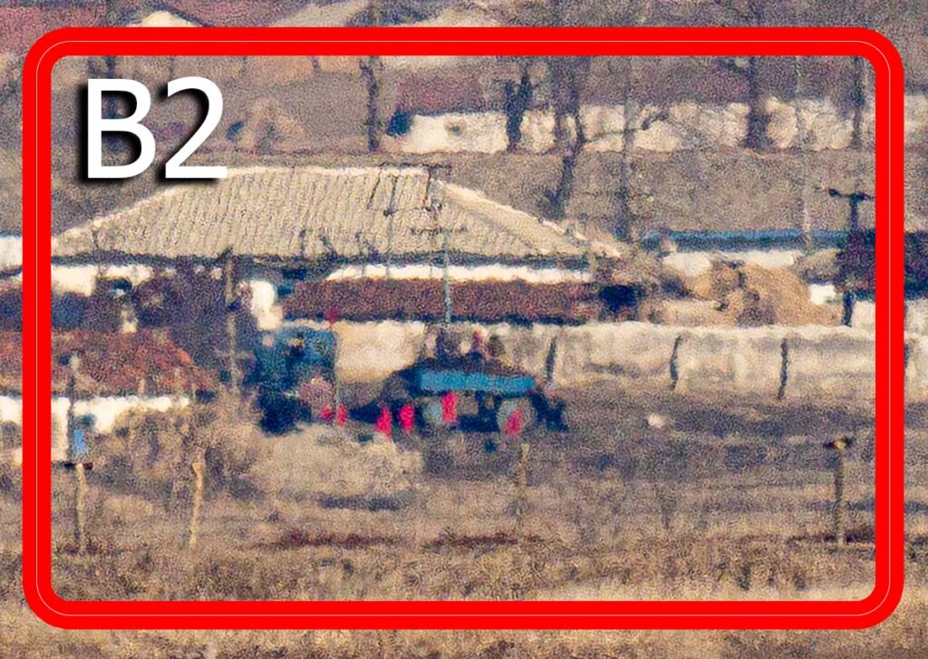
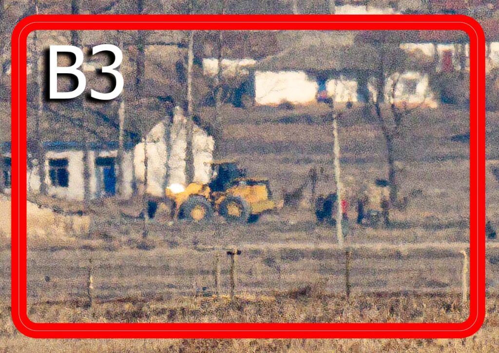
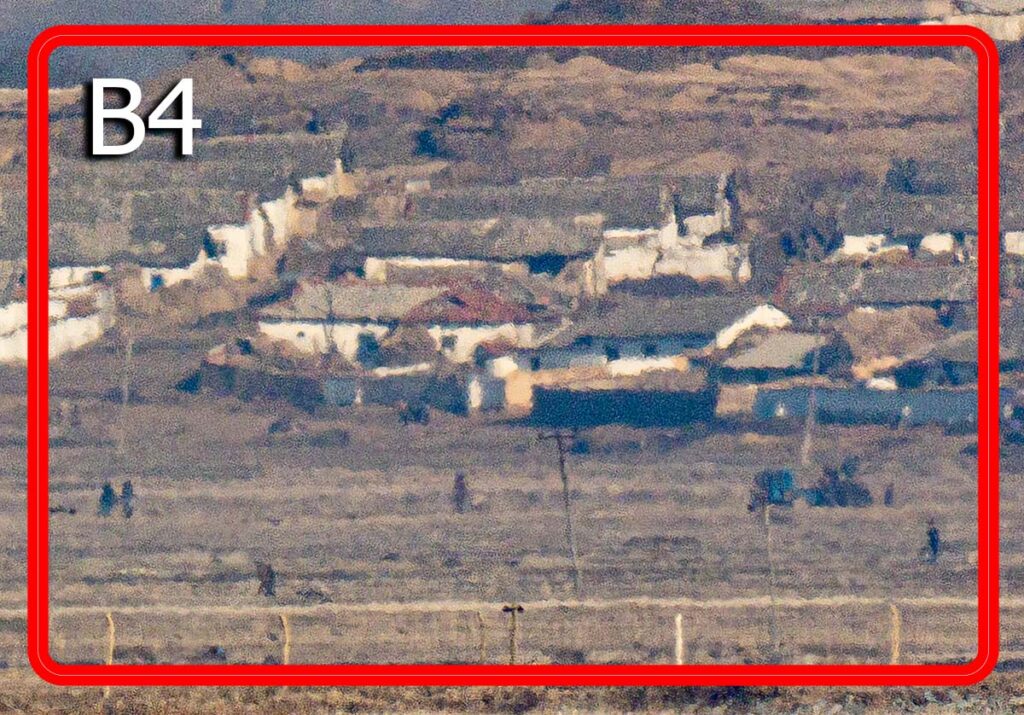
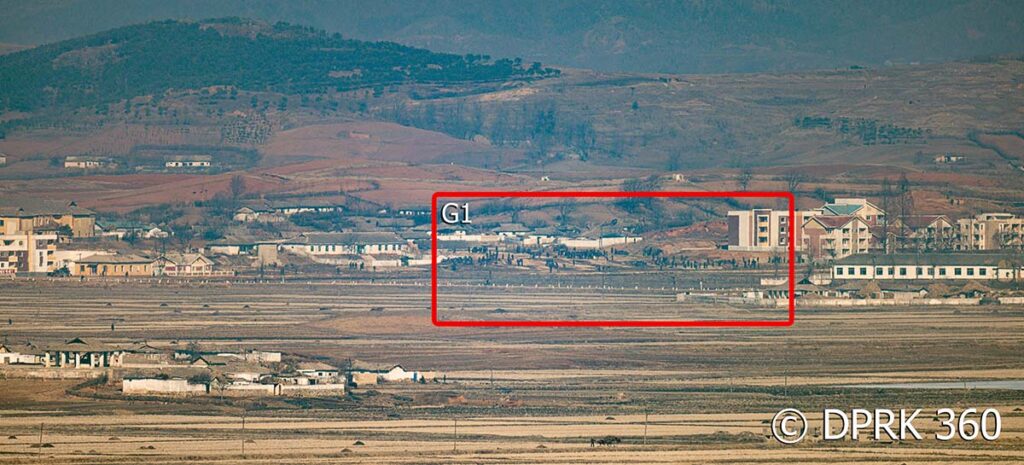
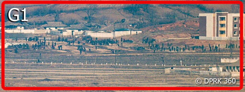
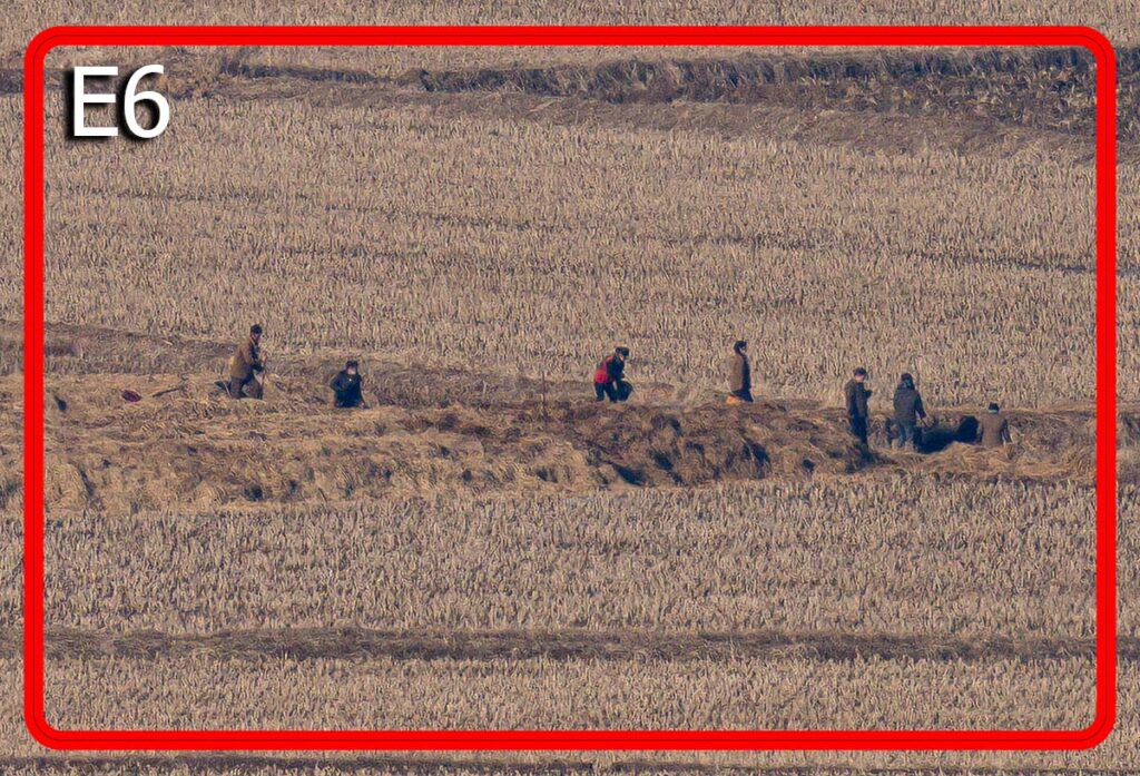
Panning across, I detected a lot of movement while peering through the camera. Thankfully the Sony Alpha 7RIV has a digital zoom function which allowed me to see a massive mobilization of people in this area. I have no way of telling what they’re doing.
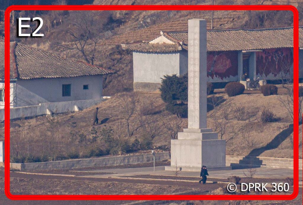
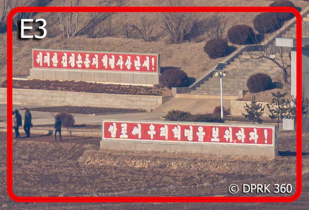
My final stop is the Aegibong Peace Eco Park. From this vantage point, it’s just over 3 kilometers away to the nearest points of interest up north.
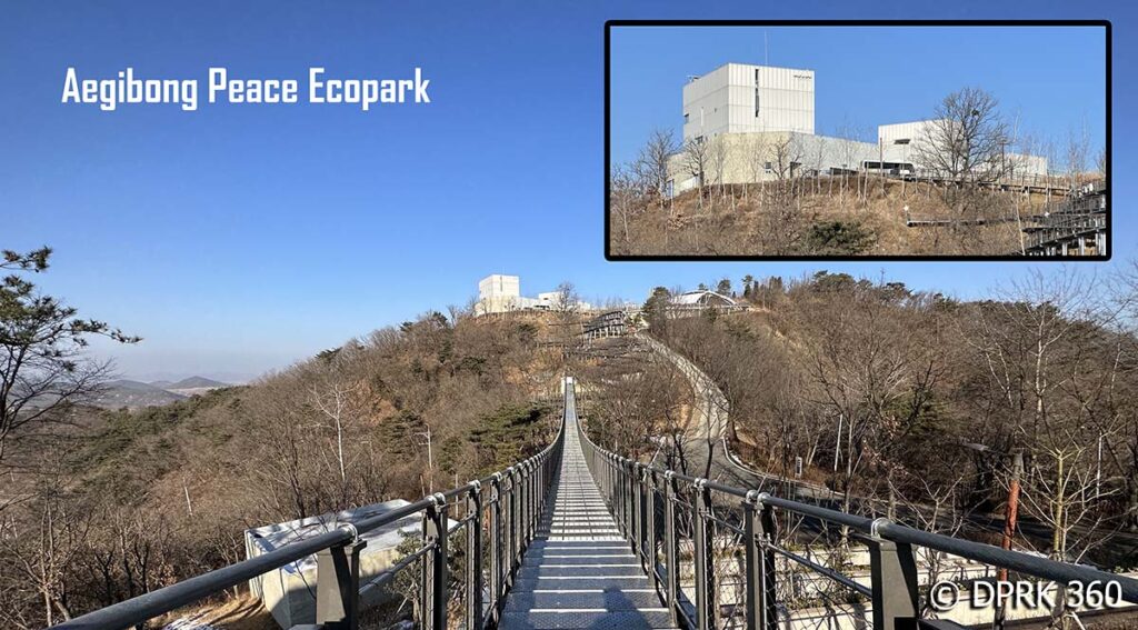
It’s quite a walk up to the observation point but the view is so worth it.
Check out my 360° photo of the Aegibong Peace Eco Park
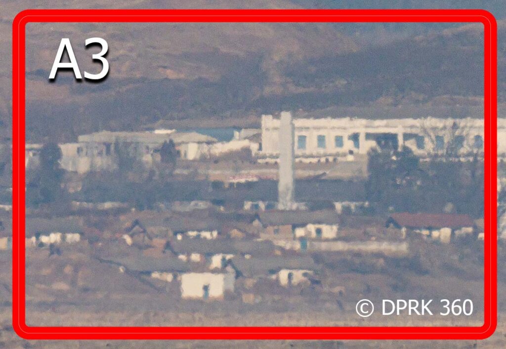
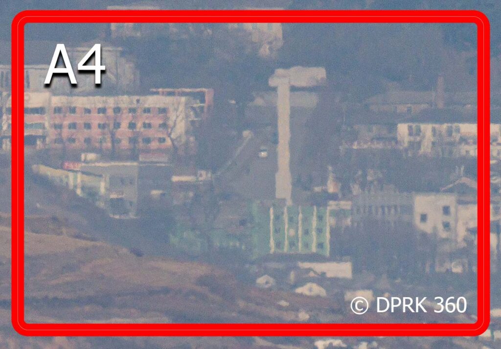
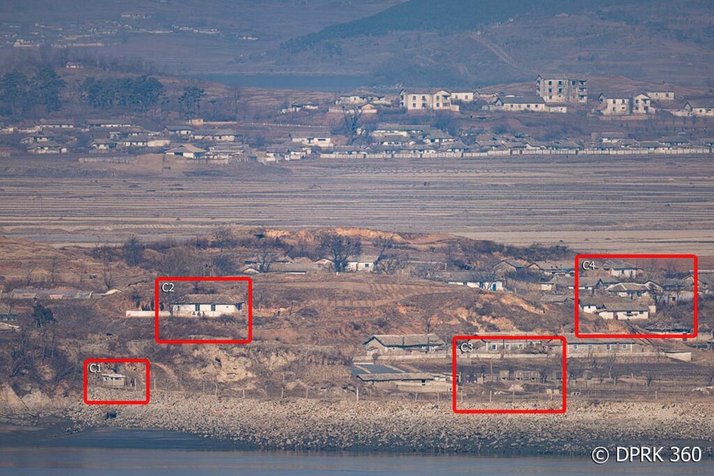
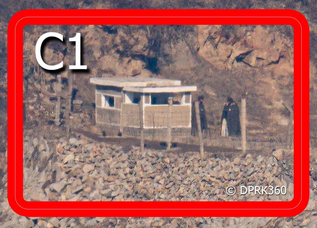
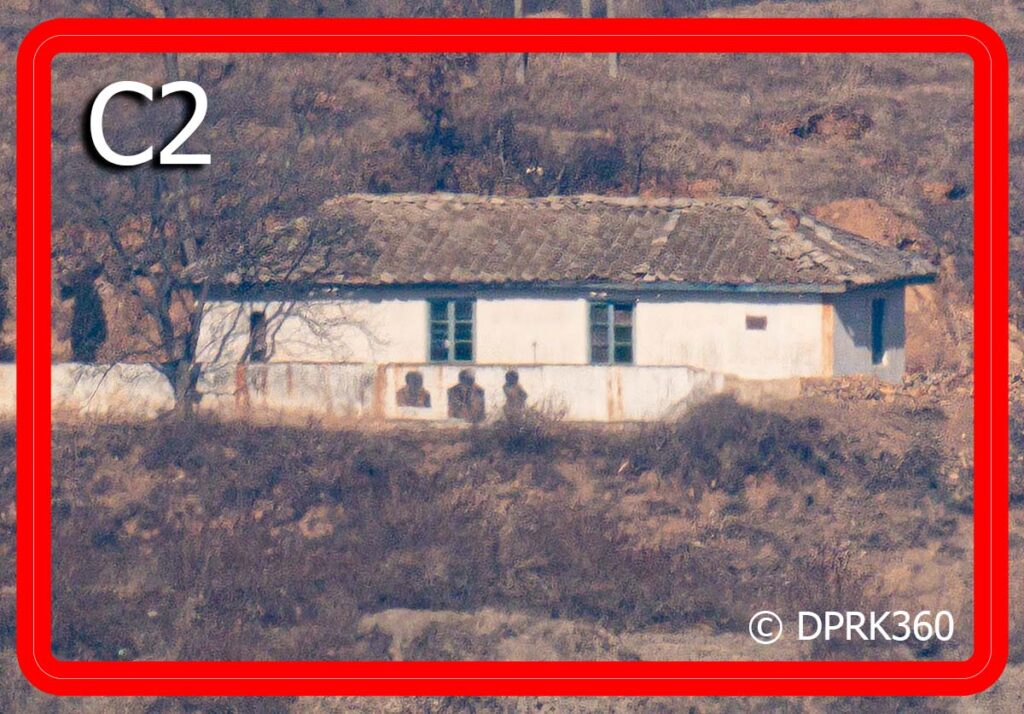
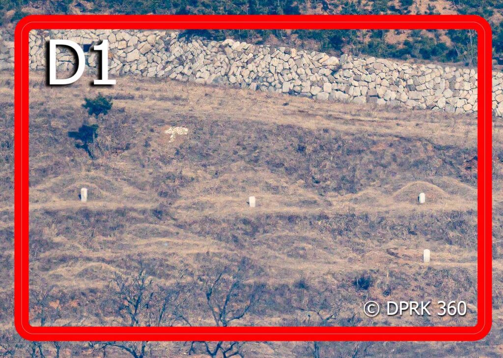
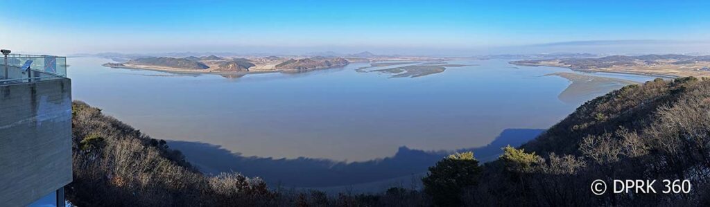
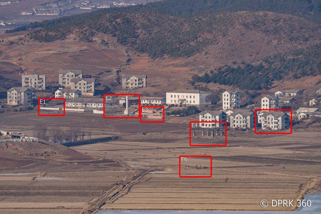
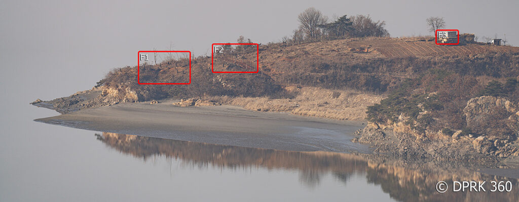
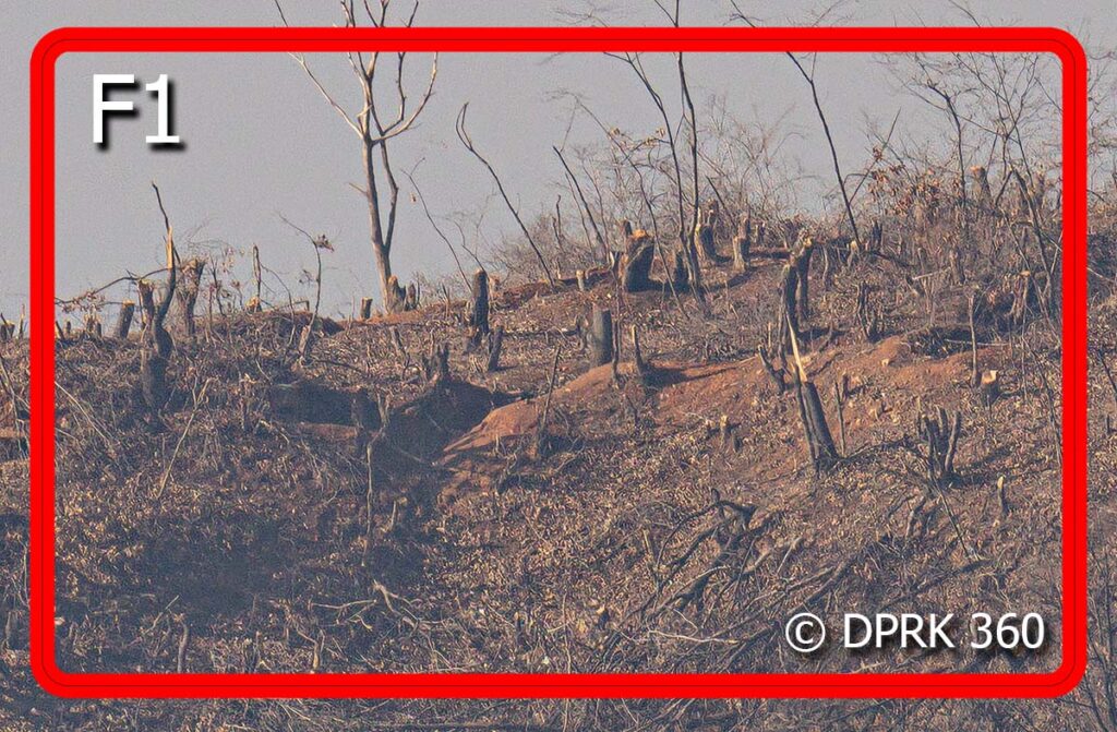
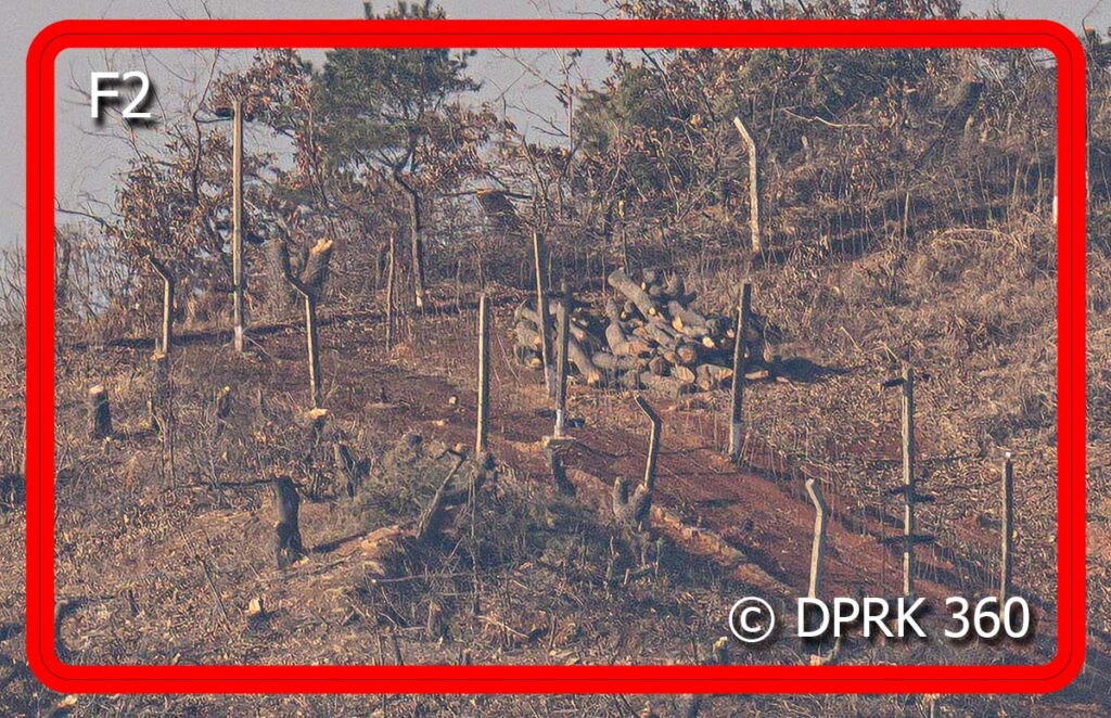
This vantage point offers the best view and seems the closest. I can really see more details and the texture of life over in the DPRK. Red highlighted photos are zoomed in crops from the original above
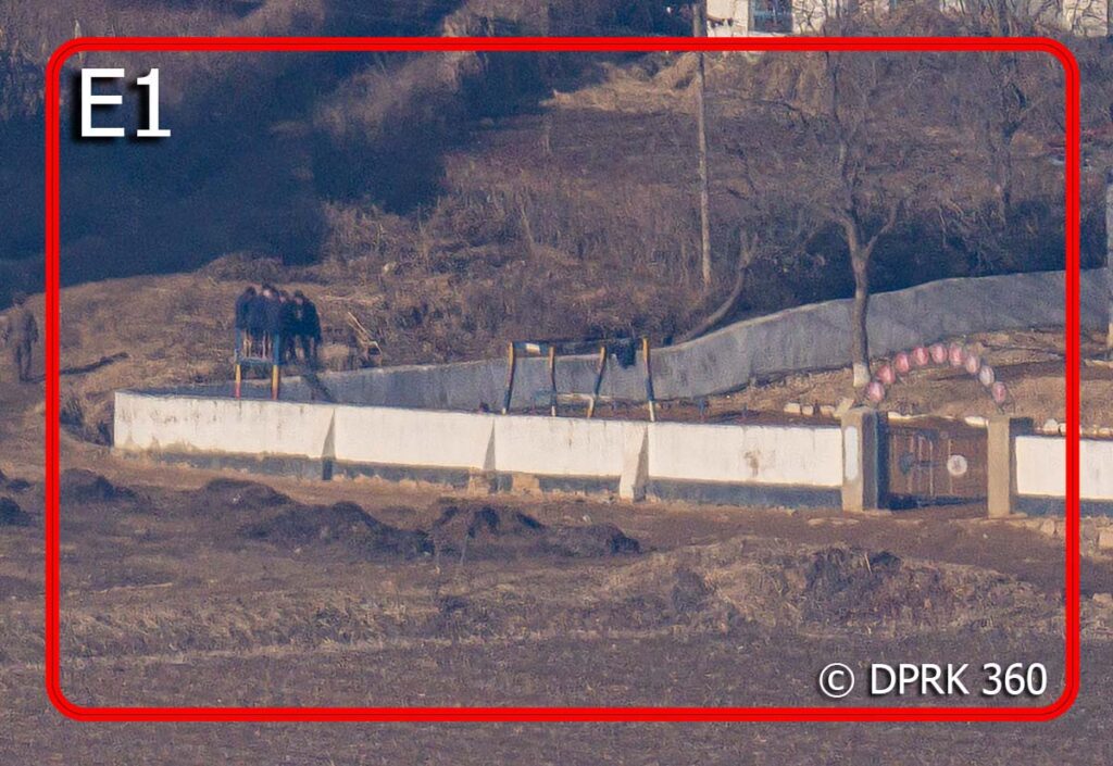
I’m not sure.
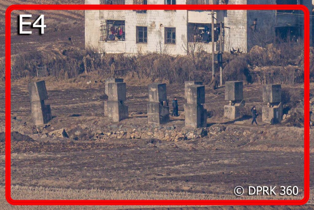
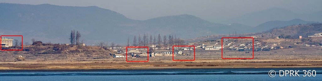
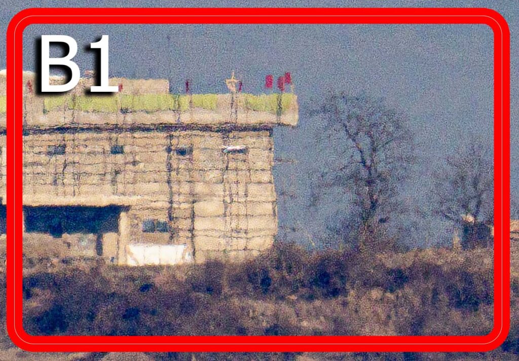
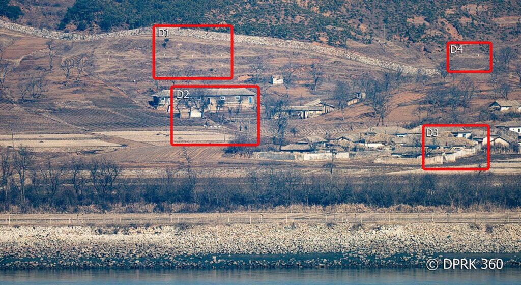
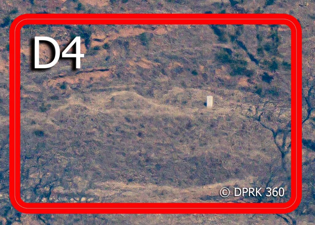
Panning around, I located a deserted but interesting spot with three points of interest.
The days are so short in winter so it was soon time to call it a day. Along the way back to Seoul, I saw South Korea’s version of an anti-vehicle barricade. In the event of war, explosive charges will be detonated on this arch to collapse the structure and block the road, slowing down advancing vehicles. It’s a poignant reminder that peace in the Korean peninsular still seems like a lifetime away. I switched over to my holiday mood and enjoyed the next few days in Seoul happily eating and shopping with my wife.
BONUS
Check out the English electronic menu at a restaurant in Myeongdong 😂